")
")


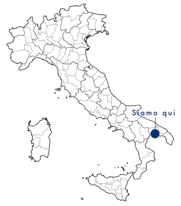
LATITUDE 40° 27' NORTH
LONGITUDE 17° 12’ EAST
![]() DOWNLOAD PORT PROFILE
DOWNLOAD PORT PROFILE
![]() VIDEO THE PORT OF TARANTO
VIDEO THE PORT OF TARANTO
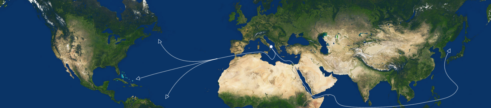
In the heart of the Mediterranean, 172 nautical miles from the Suez and Gibraltar route, in a strategic position on the main routes between East and West, the Port of Taranto is the ideal hub for commercial traffic between Europe and the rest of the world and for short-haul domestic and Euro-Mediterranean traffic.
Located on the northern coast of the gulf of the same name, the Port of Taranto consists of a wide roadstead called Mar Grande and an inlet, Mar Piccolo.
The port infrastructures are distributed along the north-western sector of the Mar Grande (Commercial Port and Industrial Port) and immediately outside it in a westerly direction (Multipurpose Pier and Pier 5).
The territorial area of the Port System Authority of the Ionian Sea (AdSPMI) - identified by the Decree of the Minister of Transport and Navigation dated 06.04.1994 and subsequently extended by the Decree of the Minister of Infrastructure and Transport dated 23 June 2004 - extends from the boundary of the Western Pier of the Aragonese Castle to the left bank of the Tara River.
 |
n.7 piers |
 |
The port area covers 4,000,000 square metres, of which:
|
 |
he overall length of the quays is 13,027 m, of which:
|
The quays are operational all year round thanks to the natural and artificial protection provided by the low tidal range.
 |
The maximum draft at the Port of Taranto is -25, made possible by the depth of the seabed at Pier 4. |